

Flash Flood Watch Issued for RI Starting Wednesday Afternoon - "High Impact" Flooding Possible
GoLocalProv News Team
Flash Flood Watch Issued for RI Starting Wednesday Afternoon - "High Impact" Flooding Possible
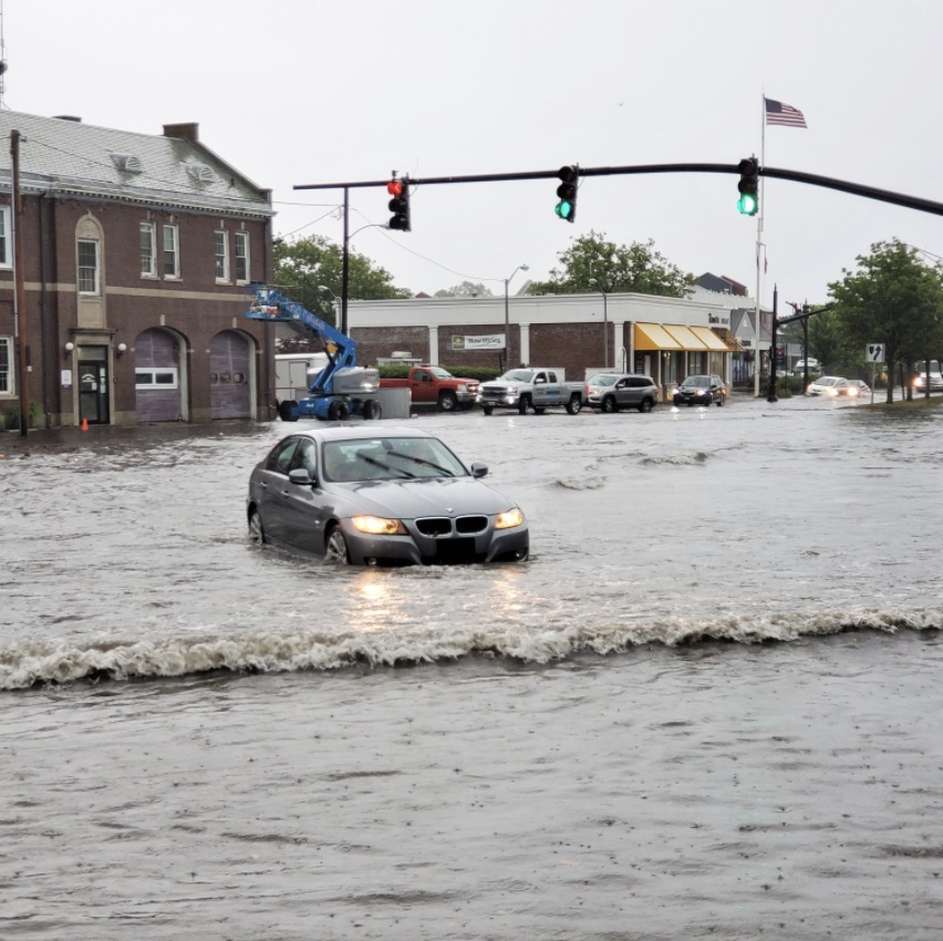
According to NWS, widespread 2.50 to 5 inches of rain is expected with isolated amounts up to 6 or 7 inches not out of the question.
This is the remnant of Hurricane Ida which devastated Louisiana over the weekend.
GET THE LATEST BREAKING NEWS HERE -- SIGN UP FOR GOLOCAL FREE DAILY EBLAST
FLASH FLOOD WATCH
National Weather Service Boston/Norton MA
311 AM EDT Wed Sep 1 2021
CTZ002>004-MAZ017>024-RIZ001>008-011515-/O.CON.KBOX.FF.A.0006.210901T1800Z-210902T1800Z//00000.0.ER.000000T0000Z.000000T0000Z.000000T0000Z.OO/
Hartford CT-Tolland CT-Windham CT-Northern Bristol MA-WesternPlymouth MA-Eastern Plymouth MA-Southern Bristol MA-SouthernPlymouth MA-Barnstable MA-Dukes MA-Nantucket MA-Northwest Providence
RI-Southeast Providence RI-Western Kent RI-Eastern Kent RI-BristolRI-Washington RI-Newport RI-Block Island RI-
Including the cities of Union, West Warwick, Providence, Foster, Warwick, Windsor Locks, Smithfield, Putnam, Falmouth, Mattapoisett, Vernon, Hartford, West Greenwich, Chatham, Brockton, Vineyard Haven, New Bedford, Coventry, Willimantic, Plymouth, Newport, Bristol, New Shoreham, Provincetown, Westerly, Narragansett, Fall River, Taunton, Nantucket, and East Greenwich
311 AM EDT Wed Sep 1 2021
...FLASH FLOOD WATCH REMAINS IN EFFECT FROM 2 PM EDT THIS AFTERNOON
THROUGH THURSDAY AFTERNOON...
The Flash Flood Watch continues for
* Portions of northern Connecticut, southeastern Massachusetts and Rhode Island, including the following areas, in northern Connecticut, Hartford CT, Tolland CT and Windham CT. In southeastern Massachusetts, Barnstable MA, Dukes MA, Eastern Plymouth MA, Nantucket MA, Northern Bristol MA, Southern Bristol MA, Southern Plymouth MA and Western Plymouth MA. In Rhode Island, Block Island RI, Bristol RI, Eastern Kent RI, Newport RI, Northwest Providence RI, Southeast Providence RI, Washington RI and Western Kent RI.
* From 2 PM EDT this afternoon through Thursday afternoon.
* Widespread 2.50 to 5 inches of rain expected with isolated amounts up to 6 or 7 inches not out of the question. This will bring the potential for rare high impact type of flooding to southern New England.
* The potential for very significant urban and small stream flash flooding exists as well as the possibility of significant River Flooding. Some roads may become flooded and impossible with perhaps even few road washouts. While the axis of heaviest rainfall remains uncertain, areas near and south of the Massachusetts turnpike appear to be at greatest risk.
PRECAUTIONARY/PREPAREDNESS ACTIONS...
You should monitor later forecasts and be prepared to take action should Flash Flood Warnings be issued.