

NEW: John Ghirose's Storm Update
John Ghiorse, GoLocalProv Meteorlogist
NEW: John Ghirose's Storm Update

1. Storm centered over Illinois this morning will move eastward and redevelop off the Mid-Atlantic coast and intensify tonight.
2. Light snow will spread across the area today but shouldn't accumulate more than an inch or two during the day.
GET THE LATEST BREAKING NEWS HERE -- SIGN UP FOR GOLOCAL FREE DAILY EBLAST3. The snow will become heavy this evening and accumulate rapidly before mixing with sleet and rain later tonight first along the coast. The sleet and rain changeover line will work slowly inland late tonight and may reach the northern border of RI during the wee morning hours.
4. The snow, sleet and rain will continue Sunday morning and wind down during the afternoon. It may change back to light snow or flurries before ending.
5. Accumulations should be in the 6"-12" range from Providence north and west with lesser amounts to the south and east with virtually nothing at storm's end right along the South County beaches. The sleet and rain should compact the snow considerably early Sunday with lots of slush around by midday Sunday.
6. One caveat: if the storm tracks farther off the coast than currently anticipated, there will be less sleet and rain and thus a higher snow accumulation in those areas.
30 Ways to Give This Holiday Season
RI Food Bank
The need for food assistance in Rhode Island remains at record high levels. Every month, the Food Bank's network of food pantries and meal sites is serving more than 68,000 people. One in three served is a child under the age of 18. This holiday season, the Food Bank is looking to collect 350,000 pounds of food between November 1 and December 31. Here’s how you can help the Food Bank achieve this goal:
- Drop off donations of non-perishable food any weekday (excluding holidays) between 8 am and 5 pm at the Food Bank, 200 Niantic Avenue, Providence.
- Organize your own food drive in your neighborhood, school, business or organization. We can provide posters and collection bins. For helpful tips, click here.
- Make a financial donation to our Holiday Meal Drive by clicking here. Every dollar you gives enables us to acquire three pounds of healthy food for a family in need.
- Visit the Food Bank's Kids' Page and learn more about how young people can make a difference.
- Attend our Holiday Meal Drive Open House on Saturday, Dec. 7.
Click here for more details about the Holiday Meal Drive.

Crossroads RI
The largest homeless services organization in Rhode Island, Crossroads has become much more than a place for the homeless to sleep. Crossroads currently offers various programs to help individuals and families tackle both immediate and long-term needs.
With that in mind, Crossroads is looking to help those in need this holiday season by encourage donor to contribute to its 2013 Holiday Gift Catalog. By donating to Crossroads, you can ensure that the state’s homeless population has the holiday that they deserve.
Click here to make a donation.
Operation Homefront
Formed in 2002, Operation Homefront is a nonprofit organization developed to support military families. On December 15, Operation Homefront will host a “Holiday Toys for Military Kids” event in Warwick from 10 a.m. to 2 p.m. Toys are limited and are on a first come, first serve registration process. Once your registration is complete you will receive a confirmation email. Please note that this program is for military dependent children only.
Click here for more details.
Coats for Kids
From now until January 11, you can donate your gently-used winter coat in order to help keep a child warm this winter. Over the past 18 years, the Coats for Kids program has collected more than 800,000 adult and children’s coats—all of which have been cleaned at no charge by Anton’s Cleaners.
“The goal of Coats for Kids is to make certain that the strong demand for warm coats is matched by the even stronger generosity of our neighbors throughout the region,” says Charles A. Anton, CEO of Anton’s Cleaners.
Those looking to make a donation can visit Jordan’s Furniture in Warwick. Click here for more information.
Toys for Tots
Beginning in October, the U. S. Marine Corps Reserve Toys for Tots Program collects new, unwrapped toys each year, and distributes those toys as Christmas gifts to less fortunate children in the community in which the campaign is conducted. If you wish to donate a toy simply drop it off at the Reserve Training Center, 1 Narragansett Street in Providence. Donations must be made prior to December 12.
Click here for more information.

Spirit of Giving Holiday
Each year, Children’s Friend “Spirit of Giving Holiday Drive” provides clothing and toys to make the winter holidays a special time for Rhode Island’s most vulnerable families. With your help, Children’s Friend hopes to help 1,200 of Rhode Island’s families this holiday season, the biggest goal ever. To participate, please visit holidaydrive@cfsri.org, call the Spirit of Giving Holiday line at 401-276-4346, or email: holidaydrive@cfsri.org.
This year’s drive is in memory of Joseph Silva, who was a dedicated Holiday Drive organizer and volunteer.
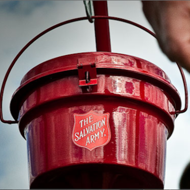
Salvation Army
The Salvation Army’s traditional red kettle is an integral part of the Christmas scene, with millions of dollars donated each year to aid needy families, seniors, and the homeless. Donations provide and financial assistance provides Christmas dinners, clothing, and toys for families in need including families of prisoners. Simply make a donation wherever you see their trademark red kettle or do so online by clicking here.

Operation Holiday Cheer
Show a Rhode Island resident serving overseas in the U.S. Military that you care by donating to the Rhode Island Red Cross’ Operation Holiday Cheer fund. You can support the project by making a donation to cover the costs of sending care packages to members of the military by clicking here. Under "Multiply Your Impact," type OPERATION HOLIDAY CHEER in the blank box under "In Honor Of."
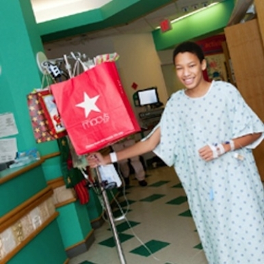
Hasbro Hospital
Would you like to help a child in need this holiday season? Consider making a donation to the Child Life Holiday Fund at Hasbro Children’s Hospital. Hasbro uses these donations to provide gifts and activities for patients during the holiday season. To donate online, be sure type in "Child Life Holiday Fund" in the "Comments" section when making a donation on their online form.
Big Brothers Big Sisters
Help a child this holiday by making a contribution to the Big Brothers Big Sisters of the Ocean State's Donation Center. Simply donate gently used clothing and small household items to generate revenue to support the program’s mentoring programs for children facing adversity.
Click here for more information and to find your closest donation center.

Family Service of RI
Family Service of RI (and its AIDS Project RI division) gratefully accepts donations of gift cards for food, clothing and other material to help needy clients all year round, and the holiday season is no exception. If you're interested in making an in-kind donation, please email
hugst@familyserviceri.org or call 401-519-2274.
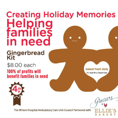
Miriam Hospital
Donating money to help those in need never tasted so good. From now through December you can head over to Miriam Hospital in Providence to purchase a deluxe gingerbread man or woman kit courtesy of Gracie's restaurant and Elle's Bakery. Gingerbread kits are $8 and all the proceeds will go to benefiting families in need. Click here for more information.

Amos House
Donations to Amos House provide direct services to the hungry, homeless, unemployed and uninsured. Here's what your donation can do this holiday season:
- $75 provides prescription assistance for a person with a medical need
- $100 provides meals for 50 hungry men, women and children
- $200 buys 10 nights of safe, supportive housing for a homeless person
- $1,000 equals a month of support for a homeless mother and her children
- $4,000 enables job training that leads to employment and national certification for an adult seeking to increase her skill level and overcome a cycle of poverty and unemployment
Click here if you wish to make a donation.
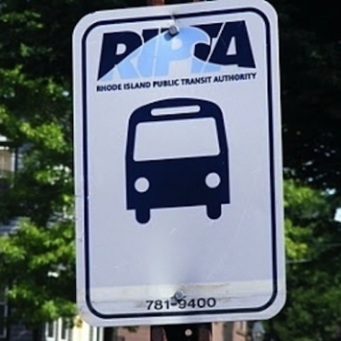
RIPTA Toy Drive
On Friday, December 6th bring a new unwrapped toy to the Providence Bruins Game at the Dunkin’ Donuts Center. The game begins at 7pm and RIPTA will start collecting toys at 3PM. There will be a large bin in the lobby that needs your help. RIPTA's goal is to fill a bus full of toys.
Attendees can meet the Providence Bruins mascot Samboni and the WBRU Crew. You can also enter to win t-shirts, tickets to see Kings of Leon, and win a VIP P Bruins experience. The first 100 people get a free lunch card from the Public Kitchen & Bar.
Click here for more information.

Hyundai Toy Drive
Help local children in need by dropping off toy donations at Pride Hyundai of Seekonk (11 Taunton Ave. in Seekonk) any time up until December 14, 2013. All donations will be delivered to Toys for Tots. Lite Rock 105 and 92 PRO FM will be on hand to celebrate the festivities offering donors the chance to win a variety of prizes including concert tickets.
Goodwill
Goodwill Rhode Island accepts donations of men's, women's or children's clothing and other textiles. Some of the clothing donations are provided to our clients who may need an outfit for an interview or a one week supply of clothing for a new job. Most is sold to neighboring Goodwill’s, or as salvage with all revenues raised going back into programs and services for Rhode islanders.
You may drop off your old clothing at one of our many clothing donation bins throughout the state or at the drop-box located in front of our building located at 100 Houghton Street, Providence, RI.
Click here for more information.
Dam Good Toy Drive
Would you like to make a child’s day by giving them a new toy, as well as laugh a little? Well you’re in luck because the Comedy Connection is hosting the third annual Dam Good Toy Drive on Thursday, December 5 at 8 p.m. The event features comedians Bad Lad, Cory Guglietti, Sam Jay and Mike Murray. Admission is free if you bring a toy. Tickets are $10 without a toy donation. This is an 18+ show.
Click here for more information.

EG Toy Drive
On Saturday, December 7th the Plenty of Singles Dance Party group will host a toy drive at the American Legion Post 15 in East Greenwich. The event will feature face painting, karaoke, pictures with Santa, arts and crafts, and balloon creations. Additionally, the group will be collecting new toys for Toys for Tots. The children event runs from 3 p.m. to 6 p.m.
Click here for more information.

United Way of RI
In the spirit of the season, the United Way of Rhode Island’s Women’s Leadership Council and Young Leaders Circle have teamed up with United Way funded agency, Connecting for Children and Families (CCF) in Woonsocket. Each year, CCF hosts a holiday party for children in their programs and their families. For many of these families, it is their only holiday celebration.
The party will be held on Wednesday, December 11 from 3 p.m. to 8 p.m. at the Kevin K. Coleman Elementary School.
The YLC will be collecting new winter accessories as gifts for the children at the event. Items include: hats, gloves, mittens, scarves, socks, boots, and shoes. Click here to download the flyer.
Photo: Flickr/paparutzi

Gateway Healthcare
As part of the Light of Hope campaign each year, Gateway Healthcare of Rhode Island collects new and unwrapped items to provide their clients with holiday celebrations.
Gateway Healthcare is a non-profit behavioral health care organization that provides a wide array of services to adults, children and families in the Ocean State.
Click here to read Gateway’s full holiday wish list.
Photo: Flickr/BenSpark

Foster Forward
Foster Forward, a nonprofit organization dedicated to supporting children, young adults, and families whose lives have been impacted by foster care, is currently hosting the “DCYF Holiday Gifts for Teens.” As part of the event, Group homes and foster parents contact Foster Forward to be matched with a sponsor. Once matched with a teen, sponsors are asked to spend about $75 for each child sponsored.
Click here to find out more information and to see how you can become involved.

Junior League of RI
Starting on November 29, 2013 at 6 a.m., The Junior League of Rhode Island, Inc. will launch its annual holiday auction; one of its major fundraisers of the year. There are many ways you can support this effort. You can contribute items, experiences or gift cards such as restaurant, store, or generics for bidding. you can donate money and Junior League will do the shopping for you.
Click here for more information.
Photo: Flickr/Aine D

ACOS Toy Drive
Help make this holiday season brighter for the children of Aids Care Ocean State by participating in Michael Slade’s Birthday Toy Drive. Just bring an unwrapped toy or Target Gift card to The Stable, 125 Washington St, Providence, RI 02903 on December 8th 2013 between 12 PM - 8 PM. Your donated toys, clothing and books will be delivered to ACOS families and their children for the holidays! Enjoy food, music and knowing you’re a part of a good cause.
Click here for more information.
Photo: Flickr/alliecreative

Dark Lady Toy Drive
The Dark Lady, The Alley Cat and AIDS Care Ocean State will present its 11th Annual Toy Drive on Sunday, December 15 from 1 p.m. to 9 p.m. at the Dark Lady in Providence. Attendees are asked to bring an unwrapped toy of Target gift card for children of ACOS.
Click here for more information.
North Prov. Rotary Club
The Rotary Club of North Providence is collecting wrapped or unwrapped toys for the North Providence Police Department Toy Drive till December 10th. Donations of new toys can be dropped off at Sicilias Restaurant starting after 6pm November 26th until December 10th. Donations may also be dropped off at the North Providence Police Station.
Click here for more information.

School Cmte. Toy Drive
North Providence School Committee members, Steven Andreozzi and Stephen Palmieri, are currently running a toy drive to benefit children of District 3, which they represent. The board members are looking for new unwrapped toys for children ages 5-12. Toys can be dropped off at D. Palmieri's Bakery in Johnston, or at the upcoming toy drive event planned for Dec. 10 from 6 to 8 p.m. at the Lymansville VFW Post.
For more information, call Joanne Andreozzi at 401-231-3069 or email smandreozzi@gmail.com. Palmieri can be reached at 401-378-4787 or by email at spalmierinorthprovschools.org.
Photo: Flickr/Lars Plougmann
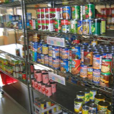
Jonnycake Center
The Jonnycake Center of Peace Dale has begun collecting food and other items for its annual holiday program. All holiday programs are being run by members of Teen Jonnycake, our youth volunteer service program.
Donations needed: Gravy mix, stuffing, cranberry sauce, canned vegetables, canned yams, canned pineapple, quick bread mix, pie crust mix, evaporated milk, canned pumpkin, and canned pie filling.
Click here for more information.
NK Holiday Giving Program
The town of North Kingstown’s Holiday Giving Program focuses on providing gifts for children in families experiencing hardship and is unable to provide the gifts themselves. Families must meet certain eligibility guidelines and an in-person interview is required.
As part of the program, individuals, families and local businesses anonymously “adopt” families in need. Donors will receive only age and gender appropriate “wish lists” from the adopted families.
For more information call 401- 268-1579 or click here.
RI CAN
The Rhode Island Center Assisting Those in Need, who provides food for the hungry, will offer nutritious holiday meals as well as Santa’s Workshop this holiday season.
In 2012, RI CAN distributed 17,901 bags of food and 4,264 bags of personal supplies to 883 households with 5,905 visits to our emergency food pantry alone–which equates to serving a total of 20,273 people annually.
For more information call (401) 364-9412 or click here.
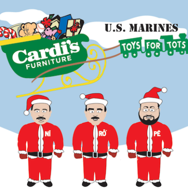
Cardi's Furniture
The 2013 US Marines Toys for Tots Drive is going on now through December 23 at All Cardi's Furniture locations. Bring in a new, unwrapped gift to any Cardi's Furniture and they will get it to the Marines and other local agencies for immediate distriubution to children in the Rhode Island area.
Click here for more information.


