

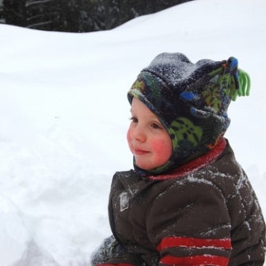
Prov Public Schools Closed on Tuesday, Parking Ban Takes Effect at Midnight
GoLocalProv News Team
Prov Public Schools Closed on Tuesday, Parking Ban Takes Effect at Midnight
A citywide parking ban will go into effect starting at 12:01 a.m. and will stay in effect until further notice.
Residents with overnight parking passes are advised that they cannot park on the street during the duration of the citywide parking ban. All vehicles parked on the street in violation of the citywide parking ban will be ticketed and towed to ensure that roadways can be plowed properly.
GET THE LATEST BREAKING NEWS HERE -- SIGN UP FOR GOLOCAL FREE DAILY EBLASTThe Department of Public Works has prepared all equipment and personnel to respond to the storm and will be pretreating the roads prior to snow fall tomorrow.
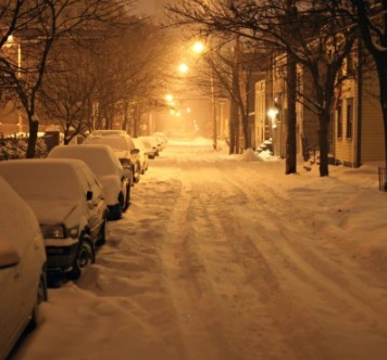
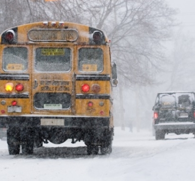
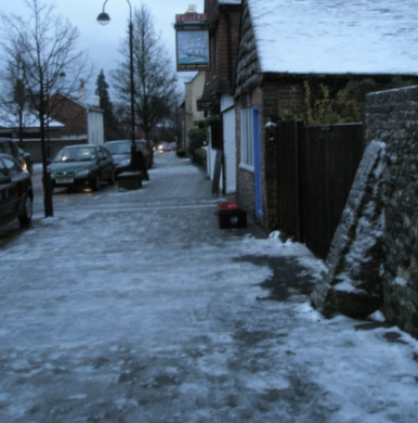
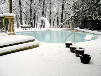
Winter Storm Coming
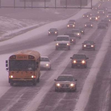
The National Weather Service has issued a blizzard watch for Providence with snow accumulation projected to be anywhere from 12 to 18 inches.
The service says the storm is expected to start between 5 a.m. and 7 a.m. on Tuesday morning.
See the Warning Below
URGENT - WINTER WEATHER MESSAGE
National Weather Service Taunton MA
346 AM EDT Mon Mar 13 2017
RIZ002-003-131600-
/O.EXT.KBOX.BZ.A.0002.170314T1700Z-170315T0000Z/
/O.CON.KBOX.WS.W.0005.170314T0900Z-170314T1700Z/
Southeast Providence RI-Western Kent RI-
Including the cities of Providence, Coventry, and West Greenwich
346 AM EDT Mon Mar 13 2017
...WINTER STORM WARNING REMAINS IN EFFECT FROM 5 AM TO 1 PM EDT
TUESDAY...
...BLIZZARD WATCH NOW IN EFFECT FROM TUESDAY AFTERNOON THROUGH
TUESDAY EVENING...
* LOCATIONS...Northern Rhode Island.
* HAZARD TYPES...Heavy snow and the potential for blizzard
conditions.
* ACCUMULATIONS...Snow accumulation of 12 to 18 inches.
* TIMING...Snow begins between 5 and 7 am Tuesday morning. The
snow will quickly become heavy with 2 to 4 inch per hour
snowfall rates possible at times, especially through early
afternoon Tuesday.
* IMPACTS...Dangerous travel conditions due to near whiteout
conditions at times and snow covered roads, especially Tuesday
morning through early Tuesday afternoon. Strong winds may result
in isolated power outages.
* WINDS...Northeast 15 to 25 mph with gusts up to 45 mph.
* VISIBILITIES...One quarter mile or less at times.
PRECAUTIONARY/PREPAREDNESS ACTIONS...
A Blizzard Watch means there is a potential for considerable
falling and/or blowing snow with sustained winds or frequent
gusts over 35 mph, with visibilities below one quarter mile, for
at least 3 hours. Whiteout conditions will be possible, making
travel very dangerous. Be prepared to alter any travel plans.
25 Winter Weather Tips - 2019
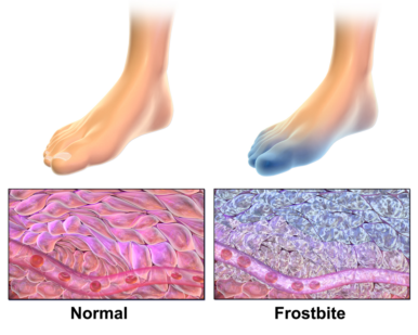
Frostbite
Frostbite develops when the skin or outer tissue becomes frozen. This condition tends to happen on extremities like the fingers, toes ears and nose. Skin may appear pale, gray and blistered as frostbite sets in, and the person may complain that their skin burns or has become numb.
If someone you know gets frostbite, bring them indoors and put the frostbitten parts of their body in warm (but not hot) water, according to Healthy Children. After a few minutes, dry and cover the person with clothing or blankets and give them something warm to drink. If symptoms continue, be sure to call your doctor.
Image via Wikimedia Commons
Hypothermia
Know the warning signs and differences between hypothermia and frostbite. Hypothermia occurs when a person's temperature drops due to time spent in the cold weather—it can often occur when you're outside on a snow day without proper clothing or when your clothes get wet.
According to Healthy Children, a person will shiver and become lethargic and clumsy, even slurring their speech in more severe cases, as hypothermia sets in. If you suspect someone is hypothermic, call 911 at once. Until help arrives, take the person indoors, remove any wet clothing, and wrap him in blankets or warm clothes.
Image via Wikimedia Commons
Prepare for Winter Storms
Ready.Gov recommends that you over prepare when a winter storm is set to wallop your region.
For your car or vehicle -- make sure you have an emergency kit, fully stocked with rock salt, sand, snow shovels and other snow removal equipment, a flashlight, extra batteries and heating fuel and plenty of clothes and blankets.
Avoid the Brakes
While you obviously want to travel slowly in harsh weather, that doesn’t mean you should ride the breaks. According to AAA, slow and cautious accelerations and decelerations are best for winter driving.
"Accelerate and decelerate slowly,” AAA said. "Applying the gas slowly to accelerate is the best method for regaining traction and avoiding skids. Don’t try to get moving in a hurry. And take time to slow down for a stoplight. Remember: It takes longer to slow down on icy roads."
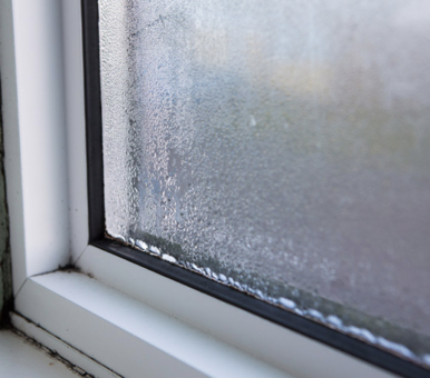
Find and Seal Leaks
Make sure to seal any air leaks in the house to keep your heating system working efficiently. You can use caulk or weatherstripping to seal air leaks around leaky doors and windows, according to the Department of Energy, and be on the lookout for other trouble spots as well.
"Seal the air leaks around utility cut-throughs for pipes ("plumbing penetrations"), gaps around chimneys and recessed lights in insulated ceilings, and unfinished spaces behind cupboards and closets,” the Department of Energy recommends.
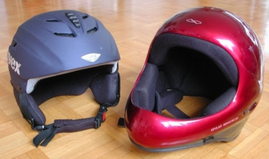
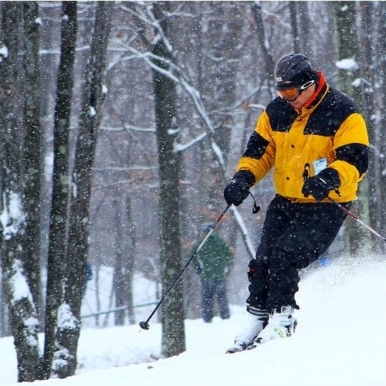
Protect Your Head
Whether your skiing, snowboarding, snowmobiling or something else, a helmet is always a good idea.
Healthy Children recommends that all skiers and snowboards get a helmet properly fitted before taking their first turns on the hill.
Image via Wikimedia Commons
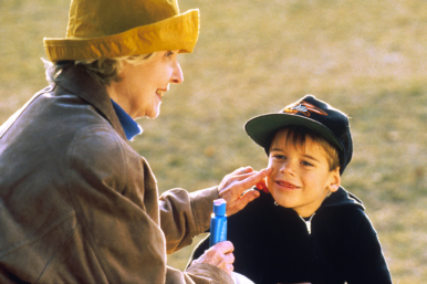
Use Sunscreen
Despite all the cold, that winter sun can be very strong—especially when it is reflected by all that white snow.
Make sure your family puts on sunscreen when they head out for a snowball fight or to go skiing—you won’t regret it.
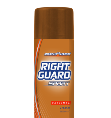
The "Right" Stuff
Planning on spending a long time outside? Steal a tip from NFL players, many of whom are familiar with exercising in freezing temperatures (just ask the Seattle Seahawks and the Minnesota Vikings.)
According to an article in Sports Illustrated, players have been know to rave about an old school method for staying warm when temperatures drop. Spraying Right Guard deodorant on your feet can keep them from sweating, and less sweat means less moisture that can cool and freeze.
Careful with Hills
Hills are particularly treacherous during the icy and cold months. Drivers should avoid both powering up hills, or stopping while traveling up a hill.
According to AAA, powering up a hill will just spin your wheels. Meanwhile, stopping while going up an icy hill can doom you. “There’s nothing worse than trying to get up a hill on an icy road. Get some inertia going on a flat roadway before you take on the hill,” AAA says.
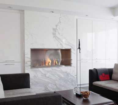
Keep the Fireplace Efficient
Everyone loves the warm glow of a fire during a snowstorm, but make sure your fire is heating your home and not making it colder.
The Department of Energy recommends keeping the fireplace damper closed unless a fire is burning. Also, be sure to lower your thermostat when the fireplace isn’t in use, that way your heating system can work at lower power.
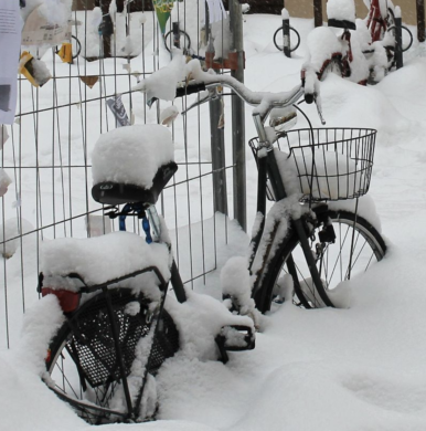
Keeping Dry
If you’re riding your bike to work during the winter, you will probably need to carry work clothes with you, so they don’t get wet or dirty from snow and slush during the ride. Our best advice is a waterproof backpack.
"It offers a slim profile and a stable 2-strap configuration,” outdoors equipment company REI advises. "A messenger bag has a single strap and, if not loaded carefully, can shift around and throw off your balance. This can be a nightmare when the ground is wet or snowy. Panniers are good but they do make your bike a little wider. This can be a concern when riding in winter because it's best to stay farther out from the curb then you would in the summer—which means that you are closer to cars than normal."
Layers, Layers, Layers
Headed out for some sledding or to build a snowman with your little ones? Make sure to use plenty of layers of warm clothes when you dress your little ones.
"Dress infants and children warmly for outdoor activities,” HealthyChildren.org recommends, "Several thin layers will keep them dry and warm. Don’t forget warm boots, gloves or mittens, and a hat."
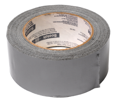
Go for Gold By Using Silver
Do you lose the feeling in your toes when you’re out on the mountain or the pond? Well an Olympic athlete recommends the great cure-all—duct tape.
Bobby Brown, an American freestyle skier, told Men’s Health about his home remedy before the 2014 Olympics. “Throw a little duct tape over the bottom of the toe of your boot. It always keeps your boots a little dryer and keeps your feet warm,” Brown said.
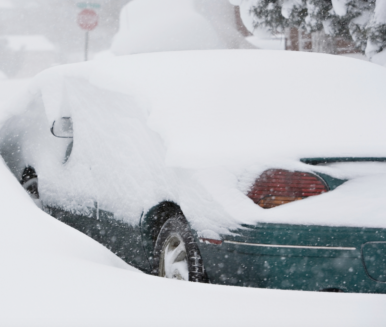
Remain With Your Car
If you’re snowbound on the roads, stay with your vehicle. It will protect you and make it easier for emergency workers to spot you, according to AAA.
"If you become snow-bound, stay with your vehicle. It provides temporary shelter and makes it easier for rescuers to locate you,” AAA says. "Don’t try to walk in a severe storm. It’s easy to lose sight of your vehicle in blowing snow and become lost."
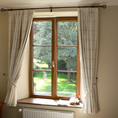
Use Sun’s Heat
While the next few weeks may be filled with low temperatures, the winter sun can be plenty strong.
The Department of Energy recommends opening curtains on your south-facing windows during the day to allow sunlight to naturally heat your home, and close them at night to reduce the chill you may feel from cold windows.
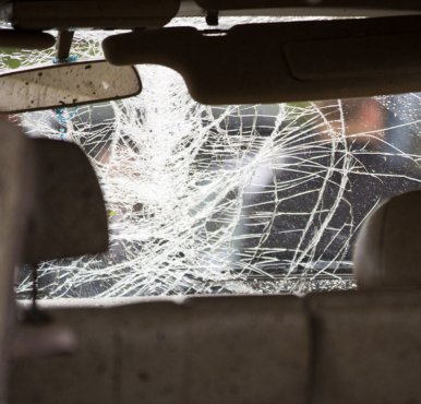
Protect Your Windshield
Winter driving experts at Geico also recommend making sure you take care of your windows and windshield during the winter.
Make sure not to use hot water to de-ice your windows, unless you’re going for a shattered glass look. Also, be sure only to use your wipers after you’ve completely cleaned and cleared your windshield—the wiper blades weren’t made for heavy lifting.
Keep Your Filters Clean
The Consumer Energy Center reminds you to clean or even replace your furnace filters.
“Dirty filters restrict airflow and increase energy use,” the Energy Center says. "Now is also the time for a furnace 'tune-up.' Keeping your furnace clean, lubricated and properly adjusted will reduce energy use, saving up to 5 percent of heating costs."
Watch for Ice
If your ride or trek to work crosses paths with places known to freeze over quickly, make sure to use extra caution.
REI has a trick for you to spot black ice. "Snow often melts in the sunlight but refreezes in lower temps or as the sun sets,” they said. "These are likely places to find black ice.”
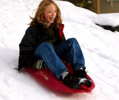
Sled Safety
Healthy Children has a few tips to make sure that your trips to the local sledding hill don’t end with a trip to the doctor’s office.
Be sure to keep sledders away from motor vehicles, trees and other crowded areas. Also note that sledding feet first or sitting up, rather than lying down and heading down the hill head-first, will help prevent head injuries.
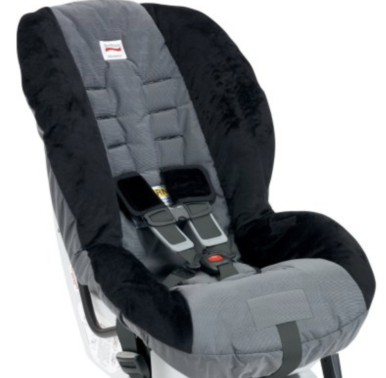
Car Seats and Winter Coats Don’t Mix
When loading up your little ones for a winter road trip, make sure you take their jacket or coat off before your strap them into their car seat.
"We know you want your little ones to be warm, but please don’t buckle your child into a car seat while wearing a bulky coat,” pleads SafeKids.org. "The coat can compress in a crash and create a loose car seat harness, putting your child at greater risk of injury in the event of a crash. Instead, lay the jacket over your children like a blanket once they’re safely secured."
Image via Wikimedia Commons
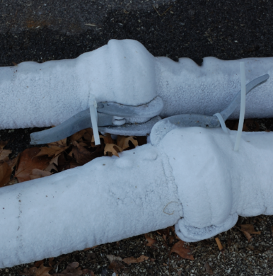
Frozen Pipes
No one wants to have their pipes freeze. If yours do, however, there are some steps to take to minimize damage to your home.
“If the pipes freeze, remove any insulation or layers of newspapers and wrap pipes in rags,” Ready.Gov recommends. “Completely open all faucets and pour hot water over the pipes, starting where they were most exposed to the cold (or where the cold was most likely to penetrate).Snow often melts in the sunlight but refreezes in lower temps or as the sun sets,” they said. These are likely places to find black ice.”

Save Some Green
Did you know that a simple adjustment to your hot water can save you more than 10 percent on your hot water bill?
By setting your water heater to the “normal” setting, or 120-degrees Fahrenheit, you can save anywhere from seven to 11 percent on your hot water bill.
Be Prepared
Listen to your inner boy scout and make sure you and your vehicle are ready for whatever Mother Nature throws at you this winter.
Make sure your car has plenty of windshield wiper fluid, and that you have a hat, pair of gloves and snow scraper handy. Also, be sure to check the weather before your start the car, and plan for bad conditions.
Warm Up Where It's Warm
Whether your running or taking a few runs, make sure you warm up inside where temperatures are nice and high. Warming up your body will help you better resist the cold.
"Move around inside enough to get the blood flowing without breaking a sweat,” advises Runner’s World. "Run up and down your stairs, use a jump rope, or do a few yoga sun salutations. A speedy house-cleaning works, too."
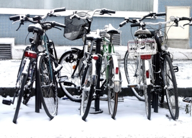
Get a Winter-Ready Bike
Riding your bike to work in spite of rain, snow, sleet or hail? Then make sure you have the right equipment to get you to and from the office in one piece.
People for Bikes says that just about any bike will work for winter riding, although you may find a road racing or time-trial bike less than ideal. "Mountain bikes, hybrids, touring bikes and old ten speeds work great. Fenders are highly recommended, as winter streets are often wet, and nothing can, ahem, dampen your enthusiasm for winter riding like having gritty, salty road-water soaking through your trousers."


